The sky watchers looked down
One stretch of Western Australia turned green enough for Landsat to see. Wildflowers reached giant radio telescopes
A satellite caught the broad change from space. At a separate site about 500 miles northeast of Perth, white, purple, pink and red flowers crowded around radio telescopes.
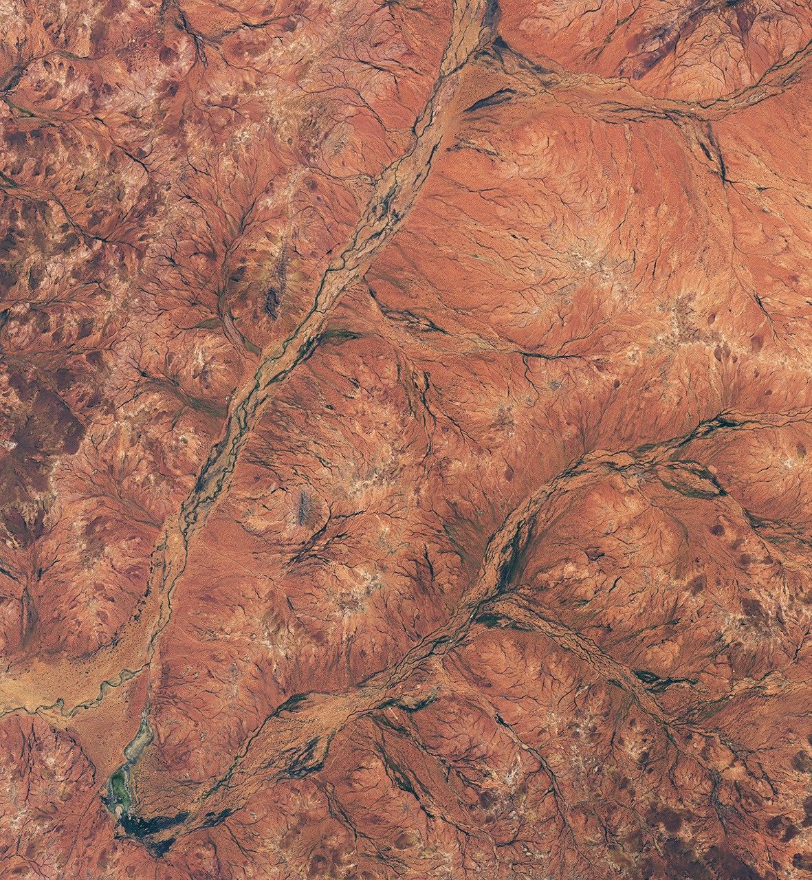
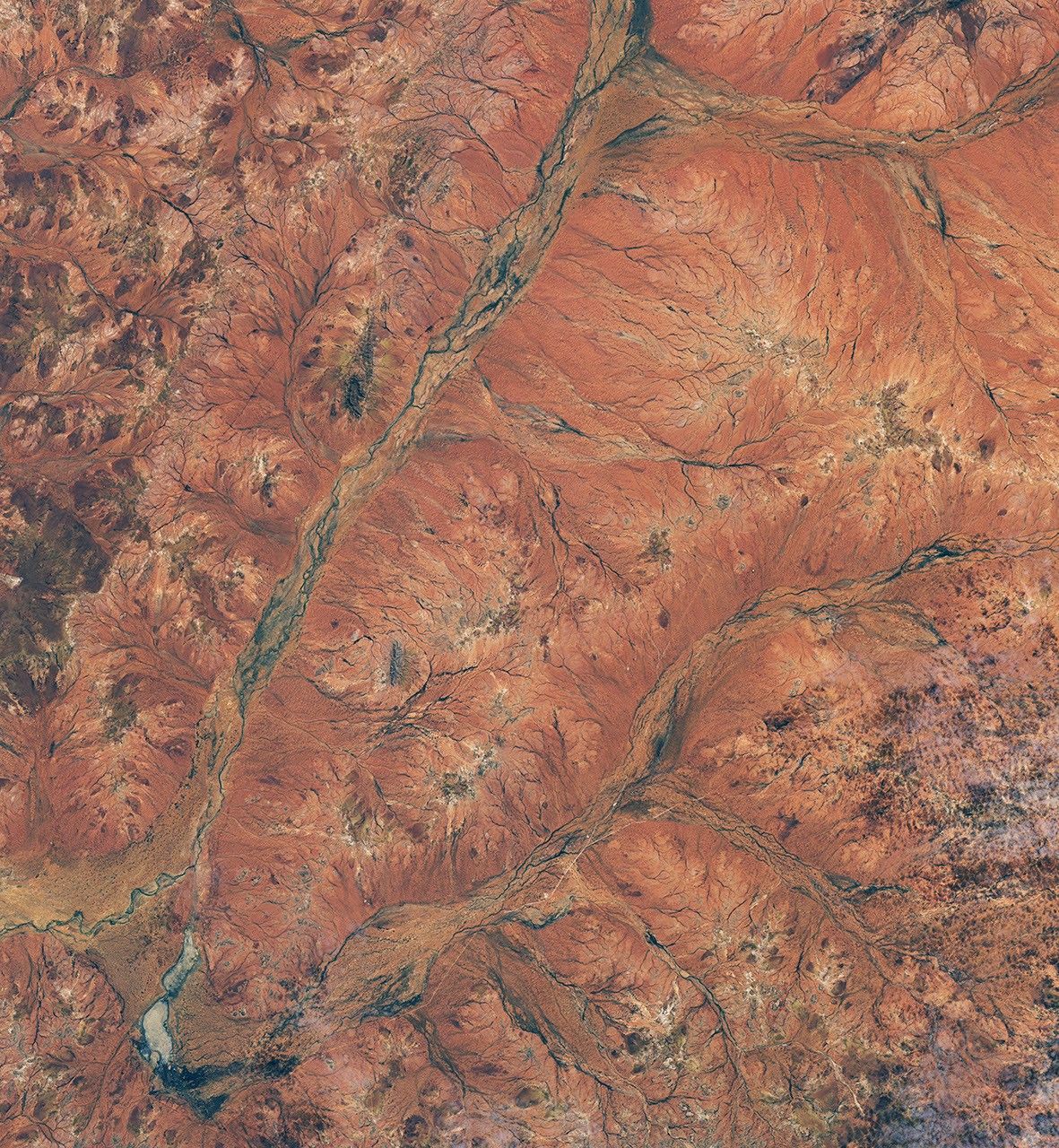
Rust color dominated NASA's August 19, 2025, view of this part of the Murchison. A Landsat image captured 376 days later showed vegetation tracing the riverbeds. At a separate observatory about 500 miles northeast of Perth, white blooms crowded the red ground around giant radio telescopes, with purple, pink and red flowers mixed through the display.
At a separate observatory, flowers reached the telescopes
The ground photographs come from Inyarrimanha Ilgari Bundara, CSIRO's Murchison Radio-astronomy Observatory on Wajarri Yamaji Country, about 500 miles northeast of Perth. NASA places the Landsat scene about 370 miles north of Perth. They document the same regional season, not one confirmed exact location.
White pom pom flowers crowded around one of ASKAP's 36 dishes, while purple mulla mulla rose in front of the array. Pink Calandrinia mirabilis and red Swainsona formosa, called marluguru in Wajarri, added color across the red ground.
Andrew Whitmarsh, CSIRO's land manager at the observatory, said dormant seeds responded to the early winter rain and produced the strongest display he had seen since 2008. Different plants usually favor different conditions, he said, but many varieties flowered together this season.
The observatory helped document more plant populations
Radio-astronomy infrastructure occupies about 0.2 percent of the observatory site, according to CSIRO. The organization's land team works with Western Australian biodiversity specialists to monitor plants across the formerly pastoral property.
One result involves Calandrinia mirabilis. The species had been listed as Priority 1 in Western Australia. It moved to Priority 3 in 2025 after additional populations were documented at the observatory.
That change does not mean the plant has become common or that its future is secure. It means researchers now know it occurs in more places than the earlier record showed.
The green followed the old water paths
The newer satellite image was captured on August 30, 2026, by the Operational Land Imager aboard the NASA-USGS Landsat 8 satellite. It shows vegetation spreading across a part of the Murchison region about 370 miles north of Perth.
The brightest green traces branching riverbeds. The image does not resolve individual flower heads; it records the broader vegetation response across the landscape.
Two wet months changed the palette
June was wetter than usual across much of southern Western Australia, and August brought another wet turn. The Bureau of Meteorology recorded a statewide June average of 30.1 millimeters, 12 percent above the 1961 to 1990 norm, followed by 24 millimeters in August, 62 percent above the norm. Cold fronts, troughs and low-pressure systems carried August rain across the state's west, south and interior.
Those are statewide figures, not measurements for the Landsat scene or the observatory. They establish the wet backdrop to two separate views of the season, one from orbit and one on the ground farther northeast.
The scene may not return next year
Whitmarsh does not expect the same display next year. Blooms in dry country depend on rain arriving in the right places at the right time.
For one August, white flowers reached the telescope dishes while, elsewhere in the Murchison, green traced dry channels clearly enough for Landsat to see.
Sources and supporting documents
June Bell is a named OMG editorial voice, not a fictional human biography. This story passed separate evidence, rights, line-editing, originality, and skeptical-review checks before publication.
NASA Earth ObservatoryBoom Year for Desert BloomsCSIROWorld-leading radio telescopes give space for stunning wildflowersAustralian Bureau of MeteorologyWestern Australia in June 2026Australian Bureau of MeteorologyWestern Australia in August 2026NASANASA images and media usage guidelines