A map built from a century of maps
Every state's geology now fits inside one searchable federal map
The colors mark geologic units assembled from decades of local work. The viewer can organize them by rock age, material and type; one shared data format is what finally made the pieces fit.
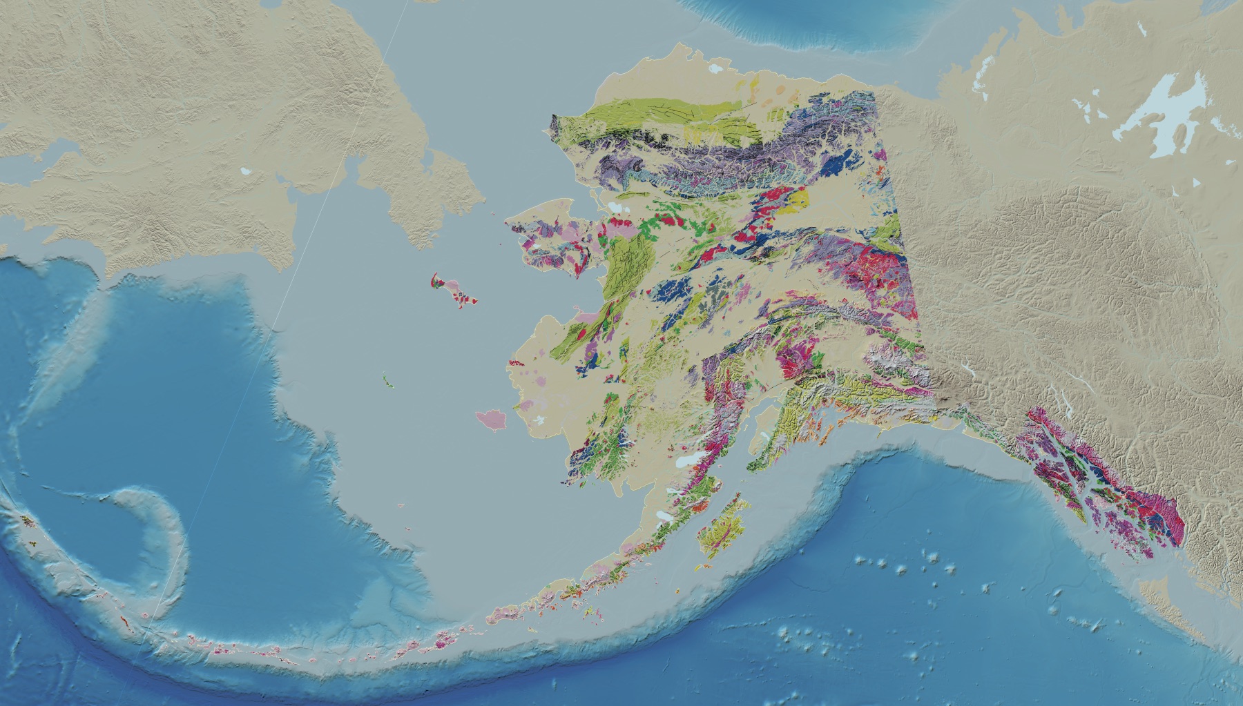
Zoom across the new federal geology map and the colors no longer stop at the Lower 48. Alaska, Hawaii and most U.S. territories now sit in the same searchable system, with rock type, age and material described in one shared format.
A Wisconsin map made the jump in minutes
One Wisconsin map shows what standardization buys. After state and federal geologists aligned their terminology, USGS says the new map entered the national layer in minutes.
The common filing system is GeMS, the Geologic Map Schema published by USGS and the Association of American State Geologists in 2020. It lets maps created by different agencies in different decades fit the same database.
Future state maps can enter through the same process, so version 2.0 is a foundation rather than a last word.
What version 2.0 added
The first Cooperative National Geologic Map arrived in August 2025 with coverage of the contiguous states. Version 2.0, released September 3, extends the standardized data to all 50 states and most territories.
Puerto Rico, the U.S. Virgin Islands and Guam are included.
The Northern Mariana Islands and American Samoa have partial coverage. The map is nationwide by state, but not complete by territory.
Alaska was never going to be a simple add-on
Alaska combines enormous distances, remote terrain and unusually complex geology. The new map makes units from the Aleutians to the North Slope searchable by age, material and rock type alongside the rest of the country.
No one remapped Alaska in a year. A century of federal and state mapping supplied the material. A shared data structure lets those maps work together.
Hawaii turns the colors into a volcanic history
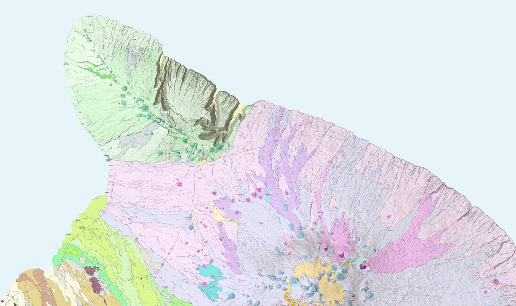
Across Hawaii, the underlying maps include basalt flows, rift zones and volcanic hazard areas. The USGS image around Kohala and Mauna Kea shows individual mapped flows across northern Hawaii.
Those layers can support hazard monitoring, groundwater characterization and land-use planning. They do not replace current alerts or tell a reader that a particular event is about to happen.
The national map still points back to local work
The public interface lets readers explore the map without specialist desktop software. The same database is also available through file downloads and ArcGIS Online.
Clicking a unit reveals its source map and other geologic publications for the area, giving readers a trail from the national view back to the work beneath each patch of color.
Sources and supporting documents
Rowan Price is a named OMG editorial voice, not a fictional human biography. This story passed separate evidence, rights, line-editing, originality, and skeptical-review checks before publication.
U.S. Geological SurveyUSGS Cooperative National Geologic Map now covers 50 states, U.S. territoriesU.S. Geological Survey National Geologic Map DatabaseCooperative National Geologic Map