Autumn starts at the top
This Nunavut tundra changed color in 41 days. Peak autumn can last a week or less
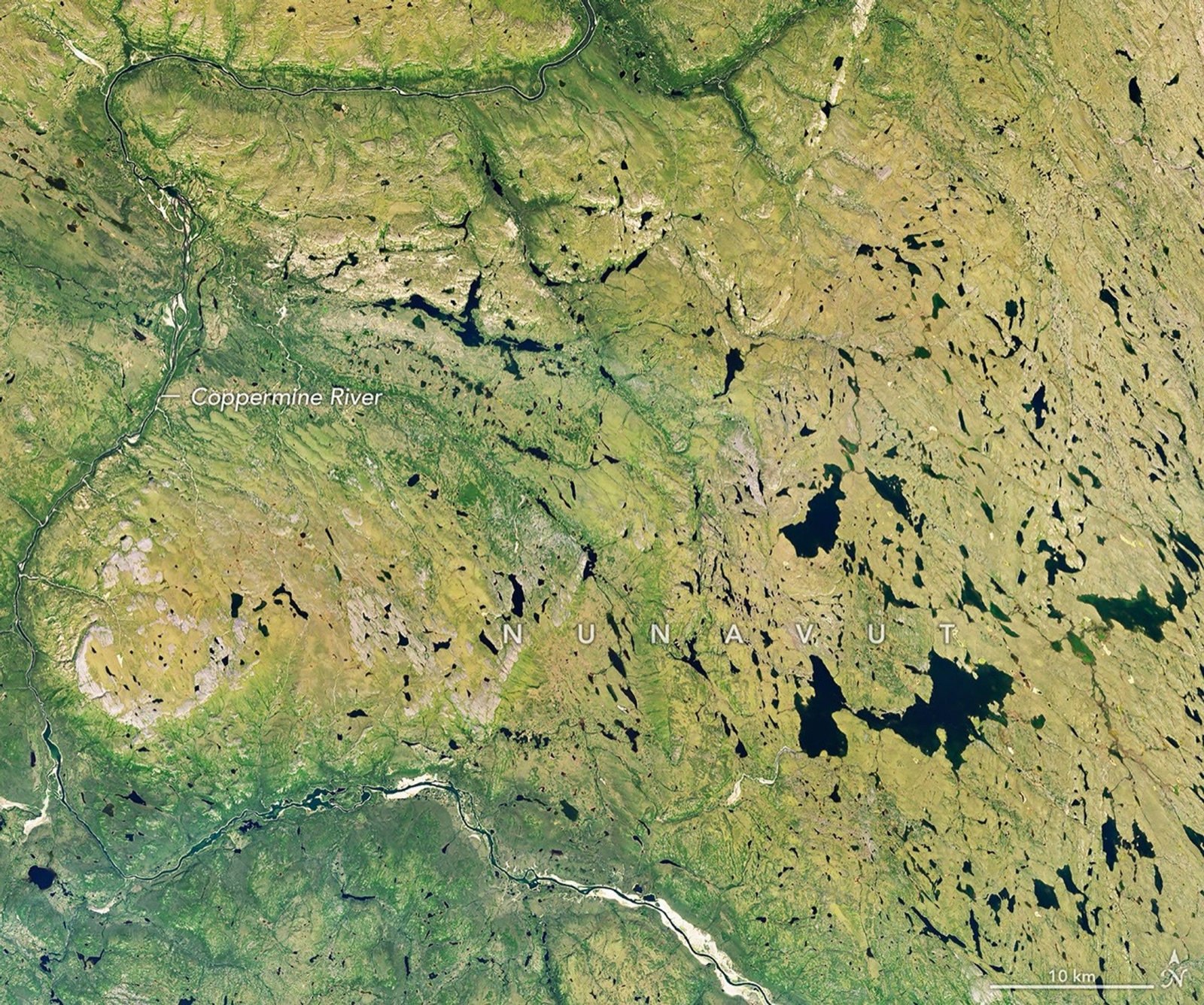
The first view is summer green. Forty-one days later, fall has spread across the shrubs and tundra upriver of Kugluktuk.
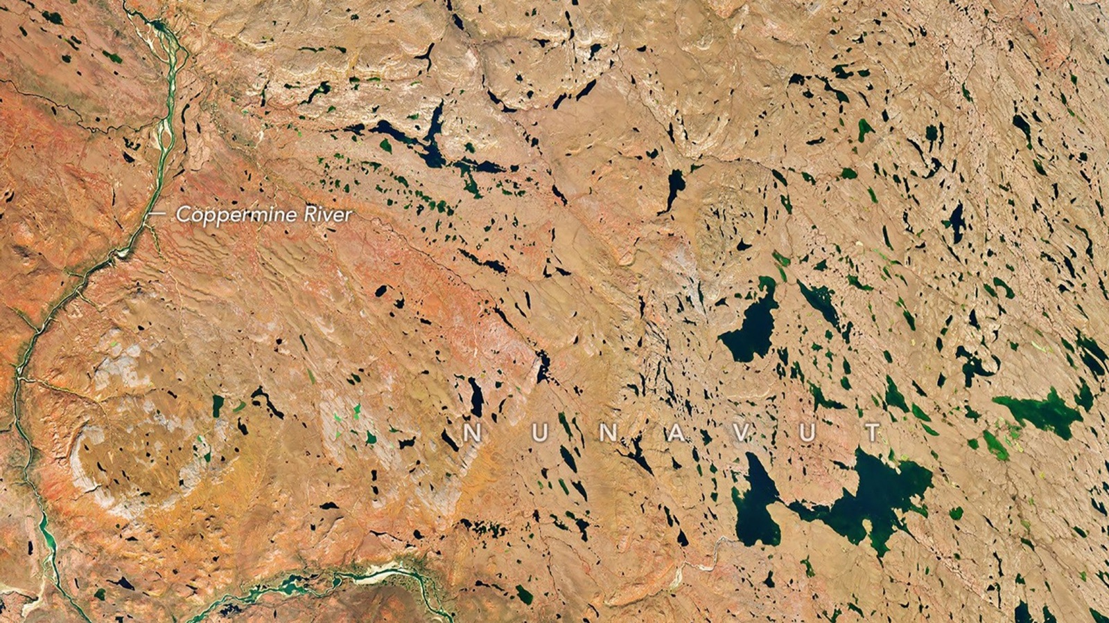
In late July, the Coppermine River cut through a mostly green tundra. When Landsat 9 looked again 41 days later, broad rust-colored bands had spread across the same ground. Autumn had reached Nunavut while much of North America was still waiting for the first turn.
Two passes, one landscape, 41 days apart
The satellite first passed over the region on July 27. Its Operational Land Imager 2 recorded a green landscape around the Coppermine River, near and upriver of Kugluktuk at the river's mouth.
The September 6 pass found the river in the same place and a different season on the ground. Red, orange and yellow had moved across the low vegetation, while dark lakes and the branching river held the two views together.
The river makes the before-and-after easy to read.
The trees are not doing the work
This is not the familiar sweep of a maple forest. Around Kugluktuk, autumn color comes from low-growing tundra plants, including willow and birch shrubs, blueberries and bearberries.
As days shorten and temperatures fall, plants stop replacing chlorophyll, the pigment that makes leaves look green. Yellow carotenoids become easier to see, while some plants produce red anthocyanins. In the satellite view, their combined change turns whole patches of tundra warm at once.
The peak can be over in a week
A NASA and South Dakota State University team studied seven years of satellite observations, from 2013 through 2019, to track six stages of fall color in deciduous forests and shrubs. The researchers found a regular march with latitude across the Northern Hemisphere.
In this part of Nunavut, color usually begins in early September and peaks around the middle of the month, according to NASA Earth Observatory. At the far northern edge of the season, the brightest stage can last a week or less.
The study did not find a significant global shift in the timing of the six phases across its seven-year window. It was a map of how color progressed, not proof of a long-term trend.
The red map is still a dated observation
The autumn image was captured on September 6 and published by NASA on September 14. It is a precise view of one pass over one landscape, not a live foliage forecast or a promise about what a visitor would see later.
That limit does not weaken the comparison. The river stays fixed between the two frames. In the six weeks around it, the tundra changes the entire palette.
Sources and supporting documents
Rowan Price is a named OMG editorial voice, not a fictional human biography. This story passed separate evidence, rights, line-editing, originality, and skeptical-review checks before publication.
NASA Earth ObservatoryAn Early Look at Fall Color in CanadaScience of Remote SensingExploration of global spatiotemporal changes of fall foliage coloration in deciduous forests and shrubs using the VIIRS land surface phenology product