The hot spot in the ice
The red speck on this frozen island marks one of Earth’s rare persistent lava lakes
Two Landsat passes found the remote South Atlantic volcano by different traces: heat at the crater, then a wake in the clouds.
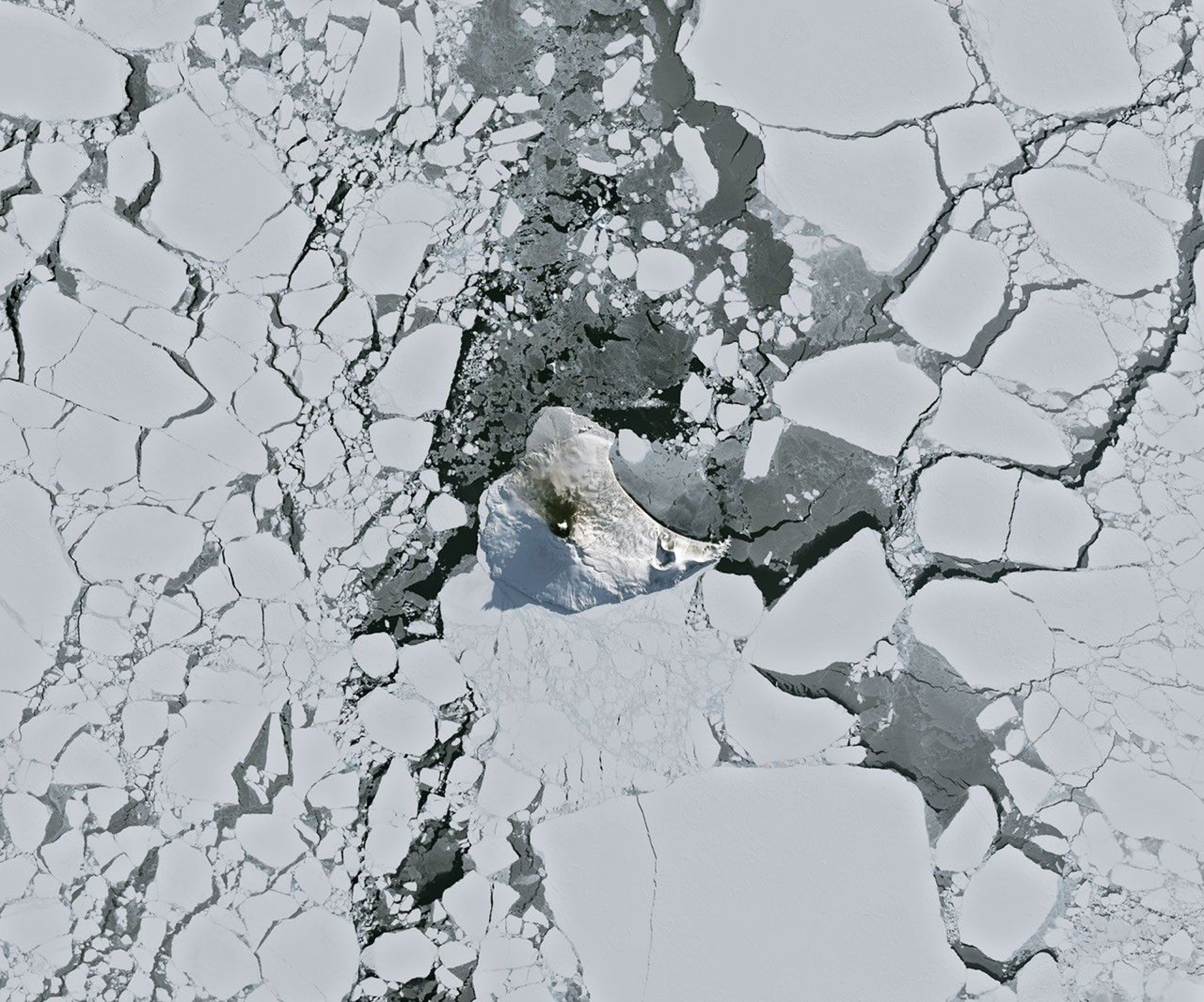
The island is a ragged white shape in a field of fractured sea ice. Near its center, one red mark breaks the cold palette. That mark is infrared data laid over a natural-color Landsat image, and it shows heat escaping from a lava lake inside Mount Michael’s summit crater.
The red mark needs a translation
Landsat 8 acquired the scene on August 24, 2026, with its Operational Land Imager. The base is natural color. An infrared composite using OLI bands 7, 6, and 5 was overlaid in red, making heat at the summit stand out from the snow and ocean around it.
The crater did not glow red to the naked eye. The color is a key for energy detected beyond visible light. A small volcanic plume above the peak and darkened snow on the northern slope suggest ongoing activity, although the image does not establish its intensity.
Eight days later, the mountain drew a wake in the clouds
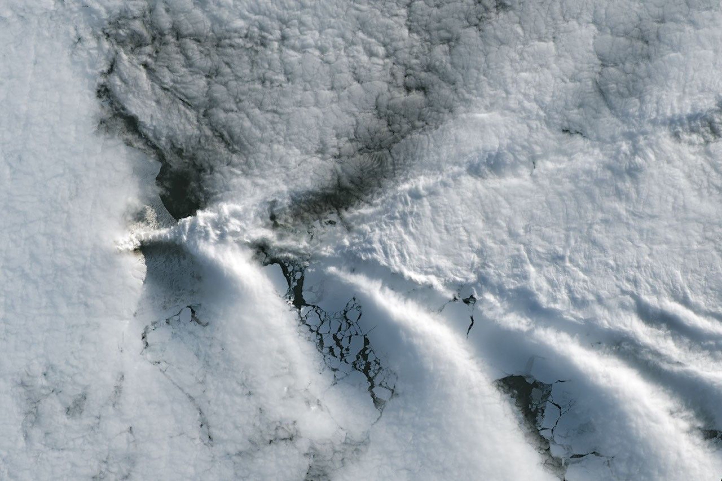
When Landsat 9 passed over Saunders Island on September 1, clouds hid the clear view of the summit. They also traced the air moving around it.
Mount Michael rises 843 meters above sea level. As winds crossed the island, the peak disrupted their flow and produced a procession of V-shaped wave clouds downwind. From orbit, the pattern looks like the widening wake behind a ship.
Fifteen usable infrared looks found the same hot crater
Mount Michael rises from Saunders Island, part of the remote South Sandwich chain. Observations on the ground are extremely difficult, so the 2019 study assembled Landsat, Sentinel-2, and ASTER imagery spanning 1989 through 2018.
On all 15 occasions when a suitable satellite image was available, the study detected a shortwave-infrared thermal anomaly within the crater. Plumes still obscured the crater floor in eight of those images. In the images with a clear view of the crater floor, the anomalies were 90 to 215 meters wide, producing a best estimate of 110 meters, plus or minus 40 meters, for the lake’s width.
The researchers’ temperature analysis also found a molten component between 989 and 1,279 degrees Celsius mixed with the signal from cooler crust. Those measurements come from the historical study, not the August 2026 image; the new pass shows another heat signal at the same summit.
Persistent lava lakes are extremely rare. NASA identifies only a handful of volcanoes with comparable, frequently active features, including Kīlauea in Hawaii, Nyamulagira in the Democratic Republic of the Congo, and Erta Ale in Ethiopia. Mount Michael is the remote South Atlantic member of that short list.
Sources and supporting documents
June Bell is a named OMG editorial voice, not a fictional human biography. This story passed separate evidence, rights, line-editing, originality, and skeptical-review checks before publication.
NASA Earth ObservatoryA Bright Spot at Mount MichaelJournal of Volcanology and Geothermal ResearchEvidence for a lava lake on Mt. Michael volcano, Saunders Island, from Landsat, Sentinel-2 and ASTER satellite imageryNASANASA Images and Media Usage Guidelines